English
The educational geological trail begins at the 9th mile of the Biokovo road, between the plateaux and Lemešinih dolaca and Jakičuše. The trail is easy and with mountain markings, and the tour on foot takes about half an hour. The invitation board located on the road along with two other educational boards placed along the track explain the origin of limestone and geomorphological phenomena of Biokovo.

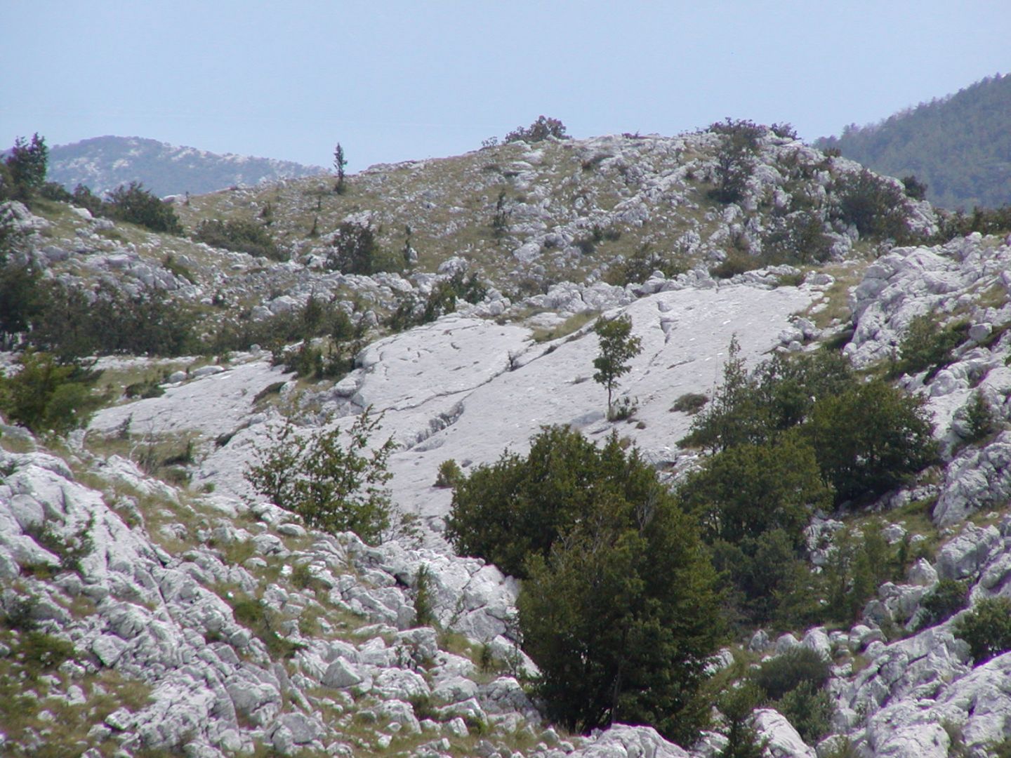
Educational geological trail under Vikovik


Educational trail Paths of ancient Berulia
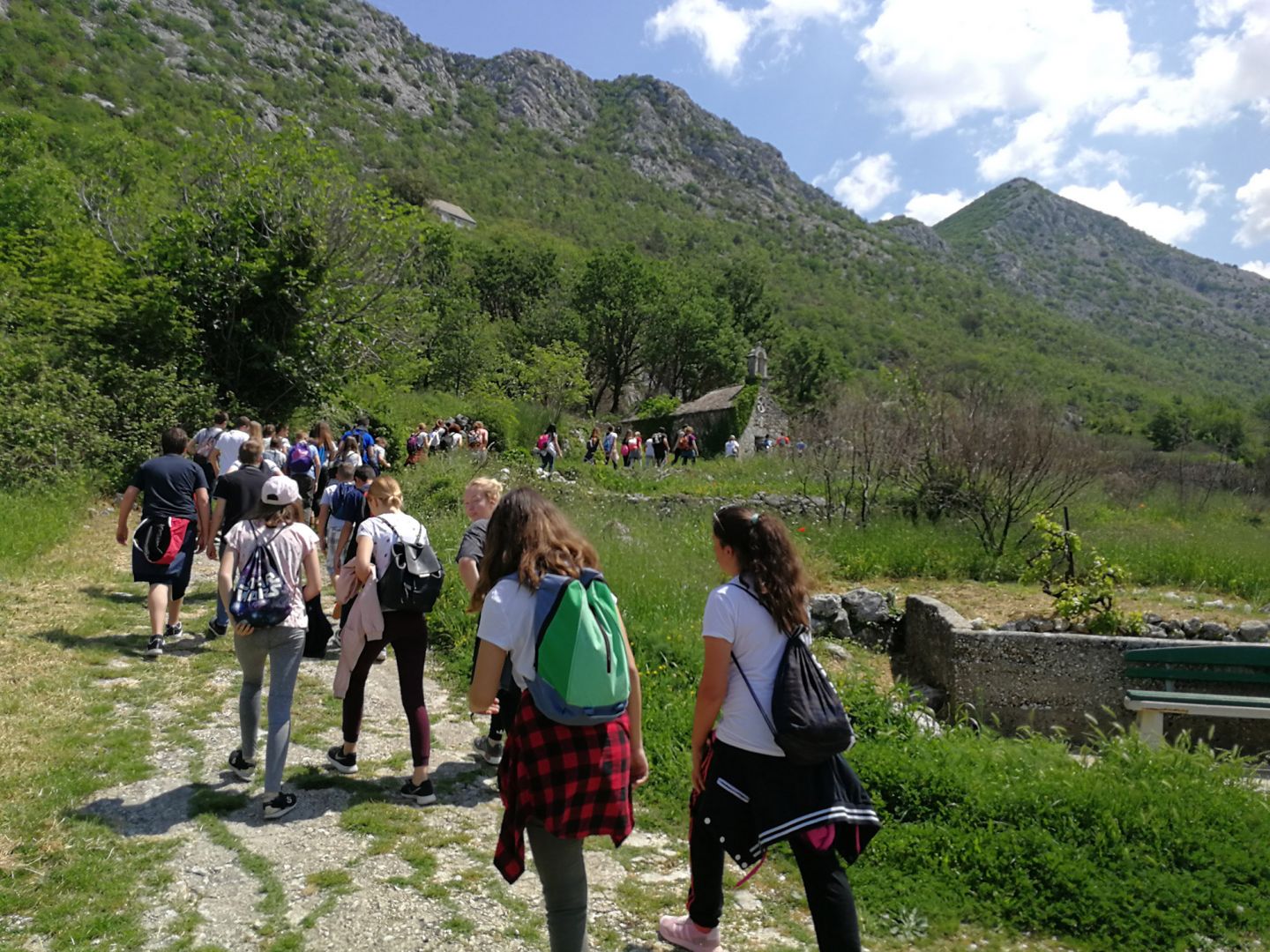
The educational trail "Paths of ancient Berulia" is a plantation with a distance of 2.7 miles, leading from the Presentation Center of Nature Park Biokovo in " Brela Gornja " in Subotišću to the church of St. Nikolas. Nine educational boards show the life of old Berulije and its inhabitants. Words and pictures tell the story of the Church of Our Lady of Good Health from the 17th century - a protected cultural property, Tomaš inns where the grain is carried out, the Gorčini - the site of the famous gentian almonds and sour cherry, Klešićima - the old village on the rocky cliffs, wells Vodice - hot "living Water, "the Mrkore lookout“ - site on the rocks of special structure and color, Dubrava - now covered with dense pine forests, where once were fertile vineyards and marasca cherries and St. Nikola - a recorded historic property from the 13th century. The trail is easy, and a tour takes about an hour.
Kaoci educational trail
The trail is about 8 km in length and leads to the Kaoci area, a significant forest vegetation area, also featuring an amphitheatre, three preserved and restored wells, an equipped rest area for visitors, and a restored forest lodge that houses the educational information centre. The trail to Kaoci is a light climb, and the walk takes about two hours. Along the trail, interpretation panels have been installed to highlight the fundamental features of Biokovo Nature Park – the geography, geology, abundant plant and animal life, and cultural heritage. The forest stands of this area, forestry in Croatia, and the history of the Zagvozd municipality have been featured separately. Next to this starting panel is the entrance ranger station, and along the trail, rest areas for visitors are planned. The trail was designed and built as part of the Forest Eye project (Protection of Nature and the Environment from Forest Fires), implemented with the objective of improving the quality of life in the border area between Split-Dalmatia County in Croatia, and Herceg-Bosna County in Bosnia and Herzegovina, reducing the damages and risks of natural catastrophes caused by forest fires, and increasing the social cohesion in the local community through joint activities and awareness raising campaigns on the protection and conservation of the environment, and stimulating the sustainable use of natural resources. The project also involves establishing a cross-border intervention firefighting team and creation of an action plan. Education information centres and educational and recreational trails were also built, including this trail to Kaoci. Multiple activities were implemented for the purpose of education and raising awareness, and promoting behaviours that help to prevent natural risks, thereby contributing to environmental protection and biological diversity. The project was financed by the European Union and implemented as part of the IPA cross-border programme for Croatia and BiH. Project partners were Croatian Forests, Herceg-Bosna Forests, Herceg-Bosna County – Ministry of Science, Education, Culture and Sport, Institute for Development and International Relations (IRMO), Public Institute of Biokovo Nature Park and the Ministry of the Interior of Herceg-Bosna County.


Educational historical trail: The Artillery Trail
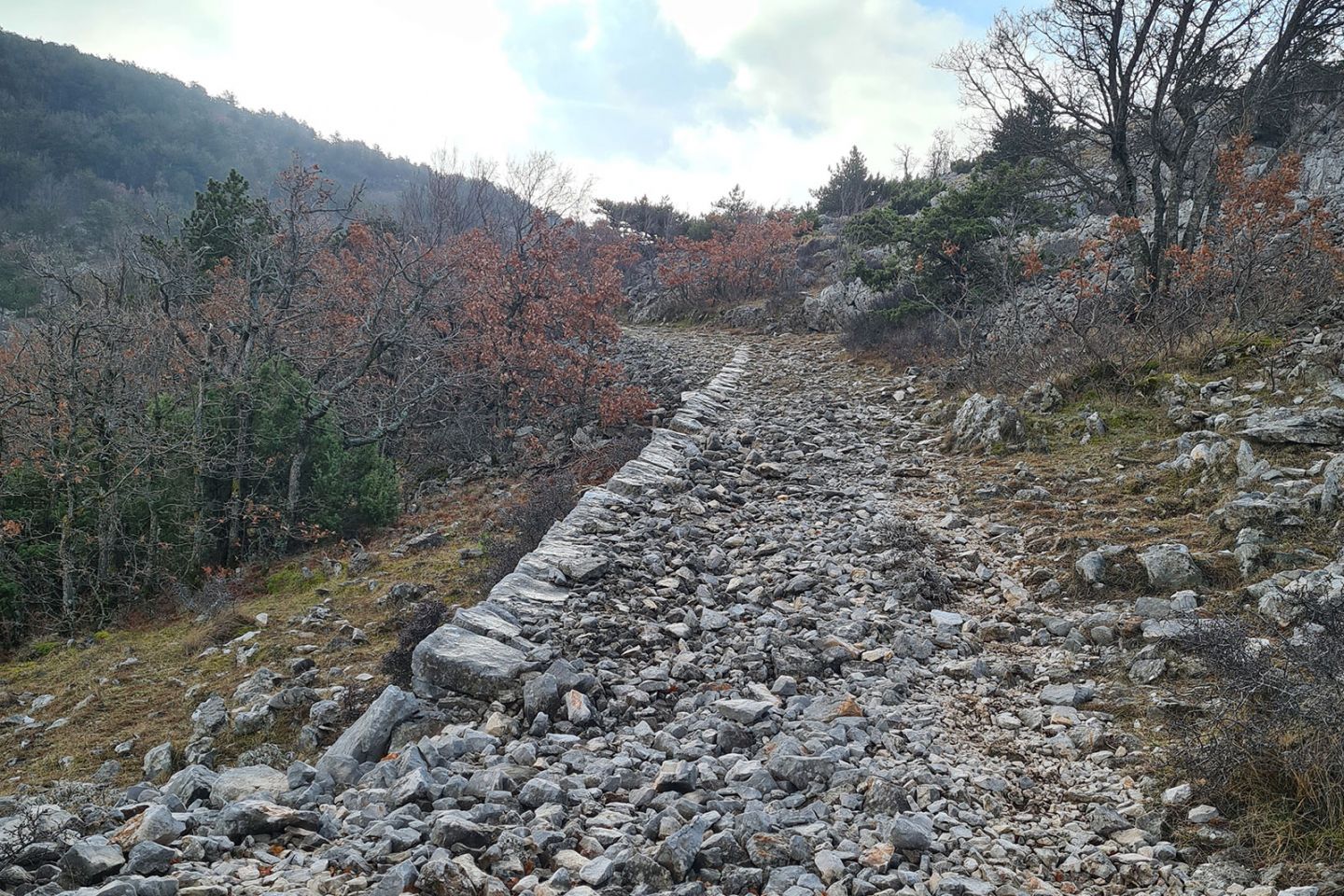
The educational historical trail 'Artillery trail' leads from the Staza Pass (897 m) to the slopes of the Supin peak (1033 m) and the artillery nests, trenches and remnants of the water tanks and barracks used as fortifications in the defence against the Entante Powers or Allies in World War I. The trail is easy, about 1,5 km in length, and takes about 1 hour to complete. Five educational panels have been installed along the trail, to familiarise visitors with the historical significance of the Church of St. Elias (Ilija), Life in the Trenches, Sarajevo Assassination, Artillery Route, World War I and the Rodić Roads.
During the time of the Austro-Hungarian Empire, in the midst of World War I, likely in early 1916, a number of fortified military positions were constructed in the area of the Staza pass (elevation 897 m) on Mt. Biokovo: infantry (at Sutvid, Stazice, Dubrava, Guvno) and artillery (Supin) positions. These military positions were constructed for defence from possible attacks or invasions from sea. The Artillery Trail was built east of the Staza pass, along the road towards Saranač just before the Supin peak. The trail includes a 1500 m long road that is 2–3 metres in width, artillery positions along the top ridge of the Biokovo slopes, automatic weapon supports, remains of stone huts, a water reservoir and defensive infantry trenches.


Educational geological trail Makar - Vošac
The Makar – Vošac hiking trail is one of the most frequented trails in Biokovo Nature Park.
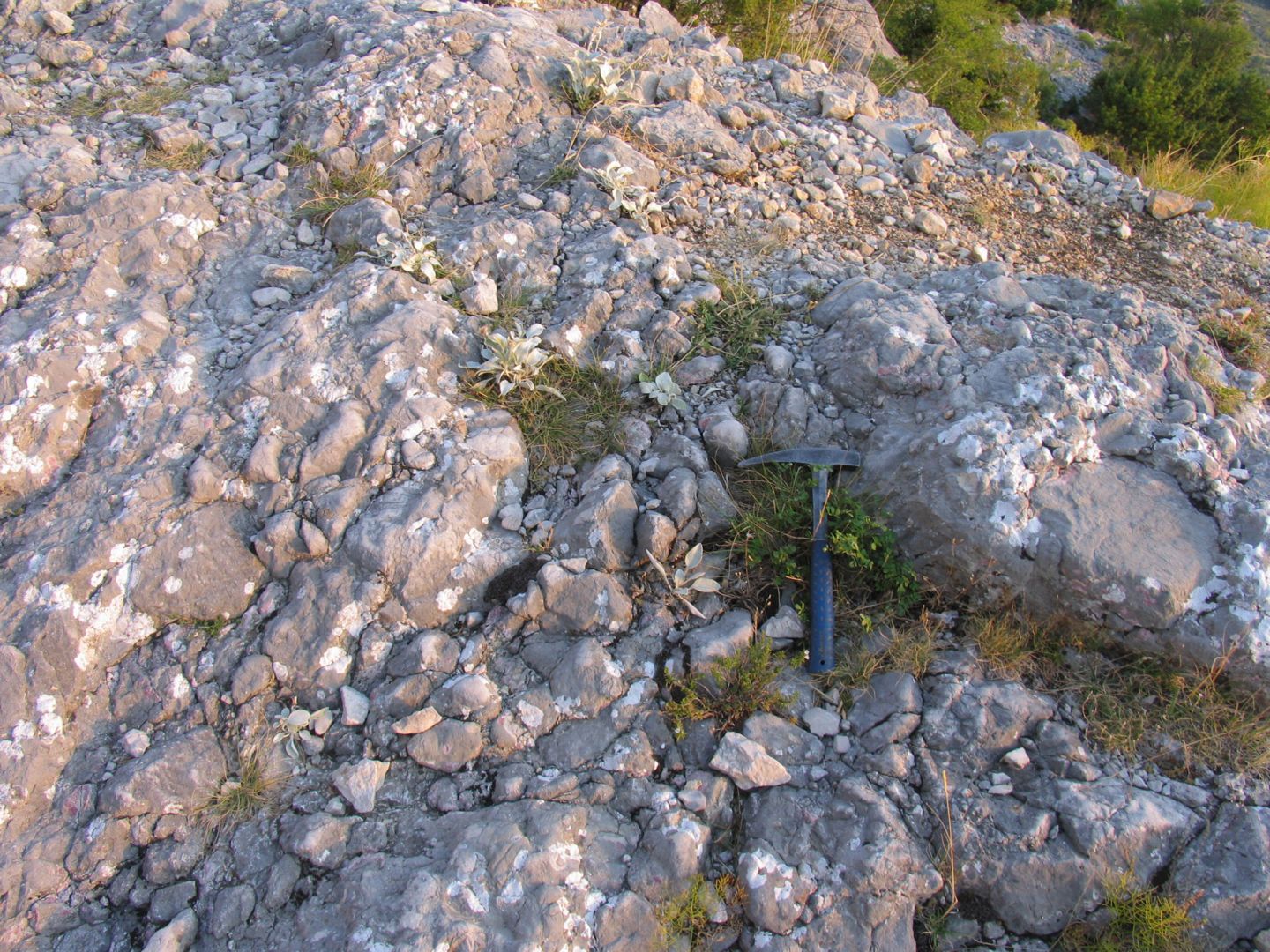
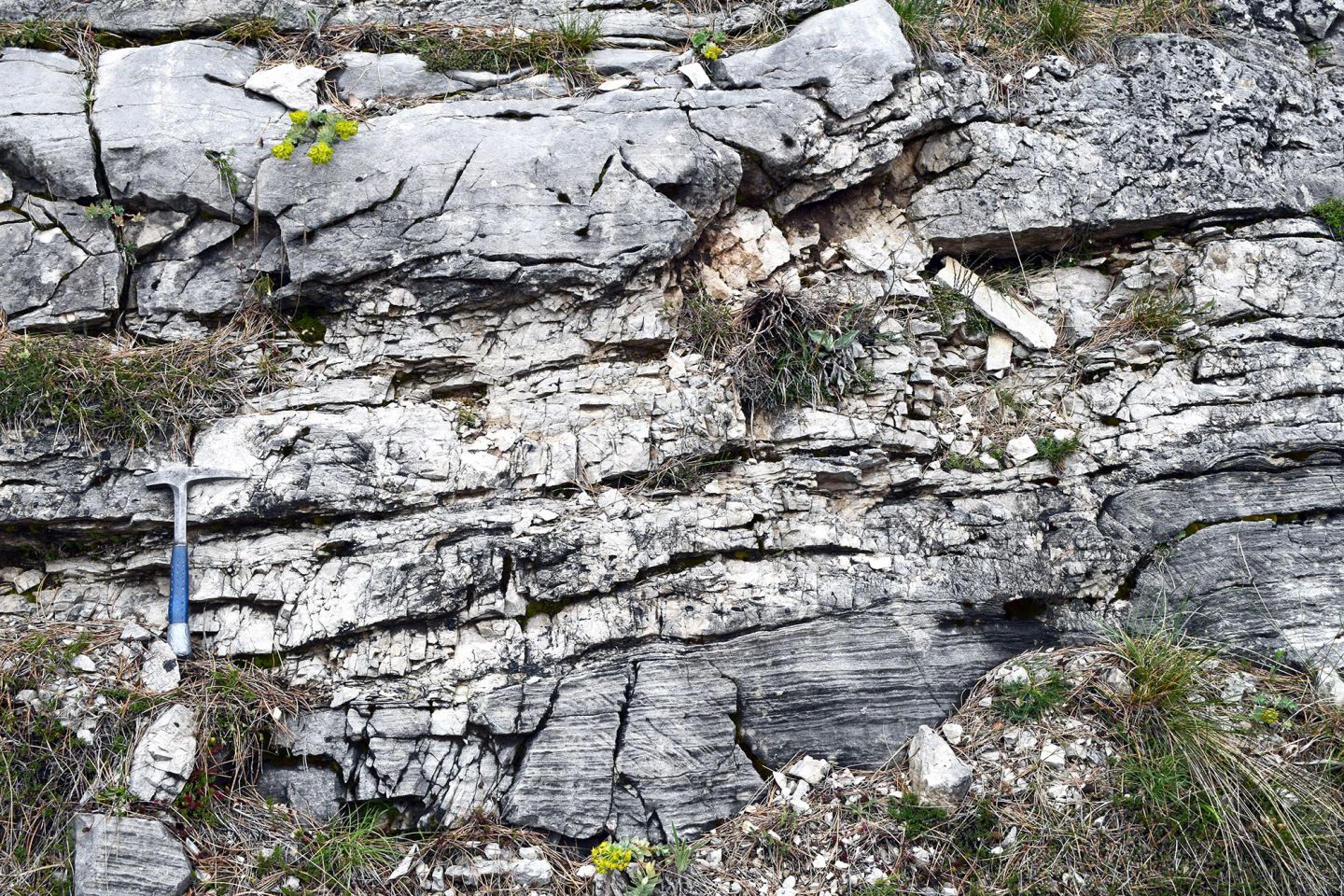
For those unfamiliar with geology and geography, geological time is a strange, often times unbelievable and completely incomprehensible dimension. However, geological history, or the age of the Earth of about 4.6 billion years, is generally accepted. In our case, when we stand on the trail near the Chapel of Sveti Ilija (St. Elias) in Biokovo Nature Park, we are standing on rock that is layered limestone of Middle Jurassic age, about 174 to 172 million years old, the oldest in the park area. Until that time, the Earth had already experienced more than 96 percent of its history. At that time, the Earth was ruled by the dinosaurs, and the Atlantic Ocean still had not been formed. The carbonate sands and silt that later created these rocks in present day Mt. Biokovo then settled in the shallows of a warm, subtropical sea lying at about the 20th parallel north. This prehistoric ocean has been called the Tethys Ocean by geologists. Since then, this “pre-Biokovo” region has travelled from about the 20th parallel north to just about the 43rd parallel north, more than 1650 kilometres. Those this is a seemingly large distance, we should not forget that this took place over an incredible time period of about 172 million years! It was not just Biokovo that “travelled” northwards, but the entire European continent, due to the movements of the tectonic plates in the lithosphere. This was caused by the pushing of the African plate, the largest at that time, against the European plate, a process that is still active to this day.
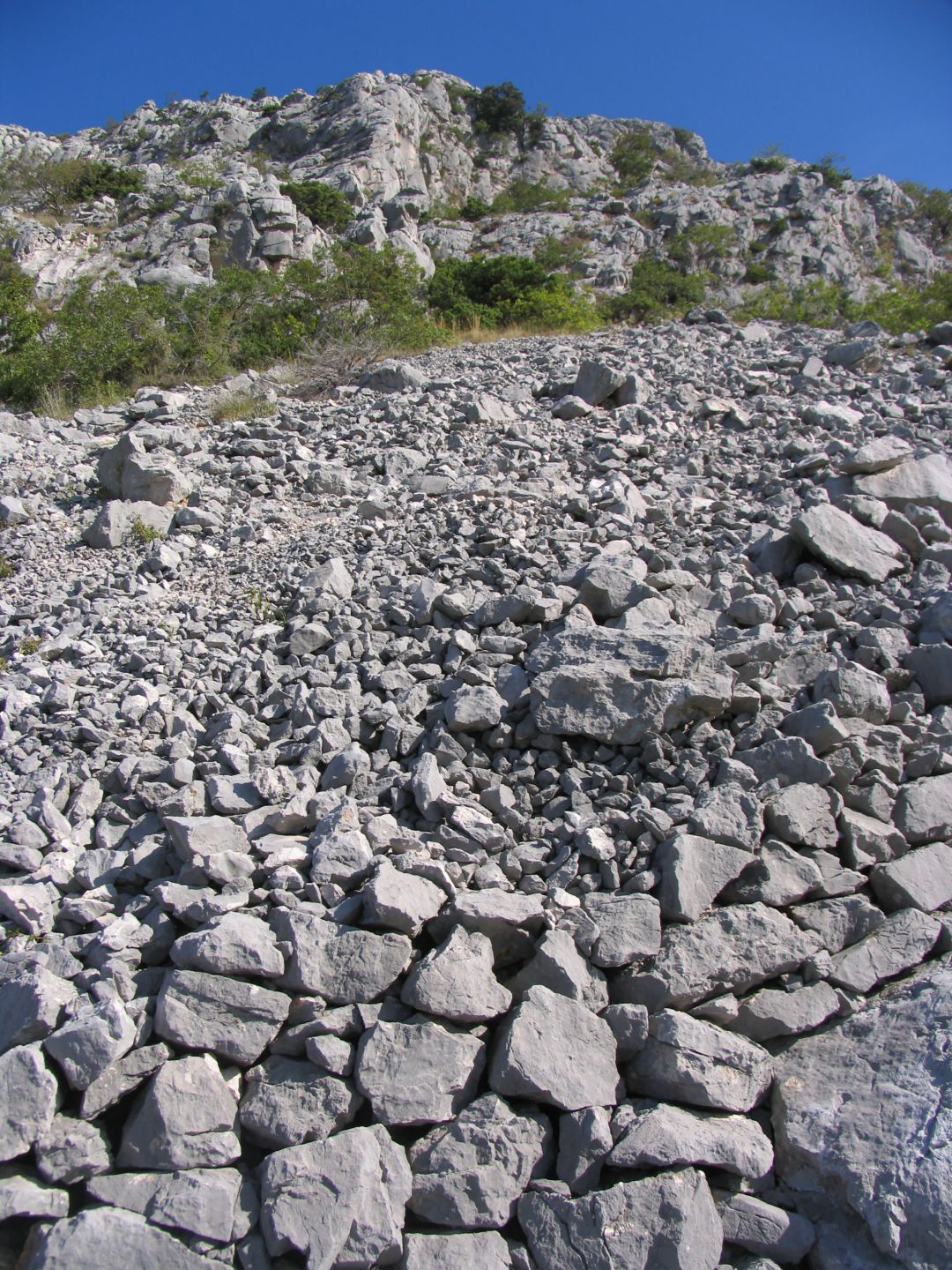
The basic groups of rock that make up the Earth’s core are igneous, metamorphic and sedimentary rock. The best known igneous, or magmatic, rock are the granites and basalt rocks. Most of the karst Dinarides (more than 95% volume) is composed of carbonate rock. These were formed primarily from carbonate silts and sands that settled in the shallow sea, where great layers of these deposits formed.
Mt. Biokovo is built exclusively of sedimentary rock and deposits. Two different groups have been identified – carbonate and clastic rock. More than 90% of the carbonate rocks are limestones, rarely are dolomites found. The main clastic rocks are flysch, glacial deposits and recent screes. Other clastic rocks found here are the limestone breccias and conglomerates, though these are made up of fragments and cobbles of limestone and dolomite.
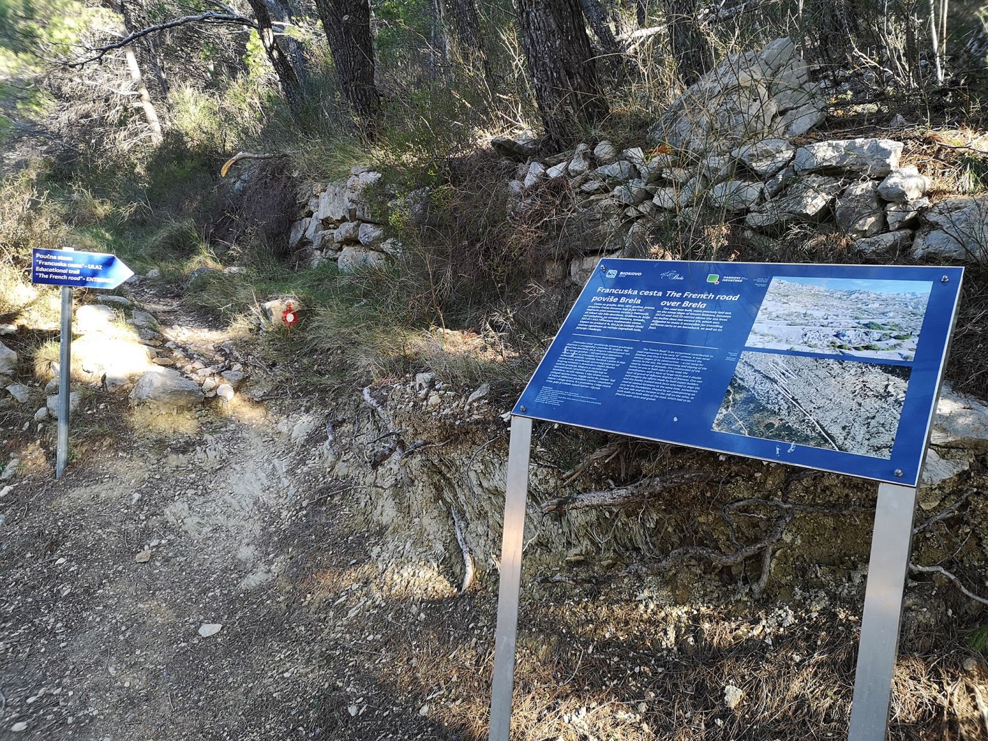
The French road over Brela
The road was built, more precisely laid out, on the steep slope of Mount Biokovo, between 357.41 and 443.73 metres above the sea level. Its incline does not exceed 6%, which was intended to make it accessible for travelling on horse carts or on horseback, as well as on foot.
The “French Road” is an exceptional contribution to the road engineering in the early 19 century. It was never finished, and thus it is possible to reconstruct the various stages of its construction: – a cut ramp for access to the site; the underpinning and sloping of the road by means of drywalls; the construction of the banks on one or both sides of the road; the stratification, with a layer of large rocks and a double layer of gravel of different degrees of fineness. One can well imagine the efforts made by both expert builders and the freshly trained work force who had to align the road at various locations at the same time, sometimes only to the foundation, shaped by an underpinning on the one side and an incision in the cliff on the other, or with walls on both sides of the road, which had to be filled in with rocks and gravel.


Javna ustanova "Park prirode Biokovo"
Franjevački put 2/A, HR-21300 Makarska
OIB: 63685777958
IBAN: HR9824070001100571153
Privacy policy | Purchase terms
 Parks of Croatia
© 2026. Javna ustanova "Park prirode Biokovo"
Web developed by:
Play
Digital d.o.o.
Authors of photo and video material:
Ksenija Protrka, Slavo Jakša, Stipe Srzić, Ante Šarić, Marko Bulatović, Plamenko Cvitić, Roman Ozimec, Ivo Pervan, Ivo Velić, Josipa Velić, Udruga BIOM, Jörg Raasch, Ante Bulić, Gordan Polić, Krešimir Žanetić, Zvjezdana Popović Perković, Hrvoje Škrabić, Filip Vilim Šabić, Matko Begović, Zvonko Glibota, Josip Belamarić, Toni Lekić, Andreas Wagner, Deni Lokas, Bruno Kuštre, Matej Milosavljević, Boris Lauš, Ivana Gabrić, Vid Ožić-Bebek, Darko Mihelj, Ivica Lolić, Toni Koren, Marijana Vuković, Ivona Burić, Mateja Ilinić, Bruno Schmidt